
Efendi boards a ferry for the trip south from Osmk to the
Altay Mountains via the Irtysh River.//
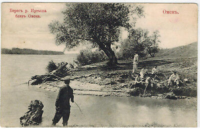
I am in Omsk. After going by the ferry pier, I learned that it would be
7 or 8 hours before my ferry would depart, not enough time to visit the
city sights but I was able to look in on some friends. Omsk's layout and
architecture are far behind the cities of European Russia but the
avenues and markets are quite lively. Everywhere I strolled there were
stores selling products for agriculture, an indication that Siberia's
farming is progressing. In and around the stores and depots were lots
of Russians making deals and buying threshing machines.
I visited a mosque that looked like a church, having been built and
given to the Siberian Moslems by the government. But one group of
Turk-Kazaks claimed that only they could use the mosque, to the
exclusion of other Moslems, and the government agreed. However,
the excluded Moslems persisted and after some heated wrangling, it
was decided that the Turk-Kazaks would use the mosque one week
and the other Moslems the next week.
An hour after the ferry departed down the Irtysh, the city was far
behind. As the ferry fought the river's rushing current, we first saw
banks on either side that were four to five meters steep. After that a
broad plain came into view on the left side, with Russian village
churches visible toward the horizon amid farms, orchards and fields.
The right side of the river was mostly vacant because the nomads had
gone to their high summer pastures. This made me think of this same
nomad-related scene stretching from the Caspian Sea and
Turkmenistan, through Turkistan and Kashgar to China.
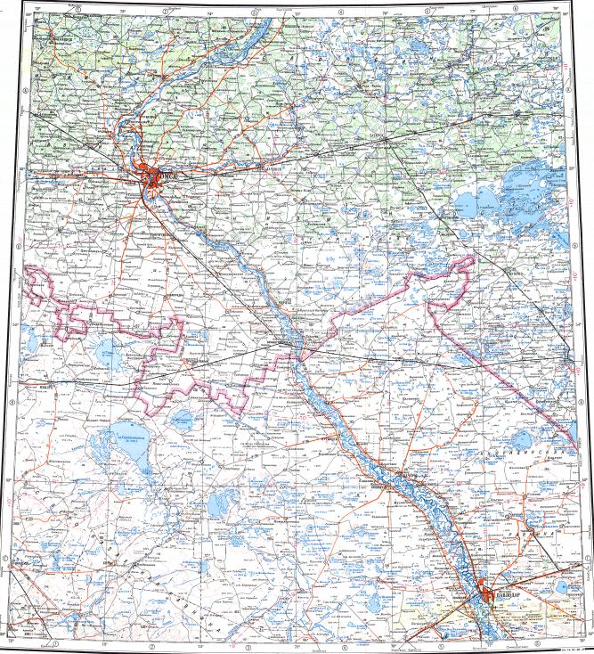
Along the Irtysh River, Omsk, at upper left, and Pavlodar,
at bottom right.
The ferry struggled against the Irtysh's fierce current as we progressed
toward the Altay plains with night approaching. Unable to see anything
in the darkness, I and the other passengers repaired to our cabins. The
next morning, our second day on the Irtysh, the scenes on either side of
the river were much the same. I had breakfast with a couple of elderly
Turk-Kazakhs, as the ferry proceeded toward Pavlodar. At night, all
the passengers had a lively time playing piano, singing and dancing,
keeping everyone awake all night long.
On the morning of the third day, the ferry had to negotiate the Irtysh's
varying currents for two or three hours before we were able to dock.
Since the ferry would only remain in Pavlodar for two hours, a friend
and I got off for a quick meal from the local Turkistani cuisine. We
flagged down a horse cart and asked the driver to recommend a good
restaurant. We agreed to a rather steep price and headed off, only to
stop moments later at the restaurant - we had been "taken for a ride"
by the driver, who had immediately recognized us as susceptible
"out-of-towners".
With an hour remaining, I walked around the city and noticed that
most of the shops had Turk-Kazakh names. This made me think that
the city's Russian name "Pavlodar" should more rightly be the name
for it that the Turk-Kazakhs use: "Kehrekev". I returned to the ferry,
which now headed off toward Semipalatinsk.
//END of PART VI//
Hiç yorum yok:
Yorum Gönder